This spreadsheet lists all U.S. ZIP codes with their county and state. You can easily lookup county by ZIP code, map ZIP codes to county FIPS codes, or view a list of ZIP codes by county. Explore the ZIP to county spreadsheet for free in Row Zero, a powerful spreadsheet built for big data.
Open ZIP to county spreadsheet
Dataset Summary
 This free ZIP code to county spreadsheet includes several different sheets of ZIP code to county crosswalks using data from the U.S. Census Bureau and U.S. Office of Housing and Urban Development. You can use these crosswalks to easily map ZIP codes to county fips codes, lookup county by ZIP code, or filter to a list of all ZIP codes by county. Note that this dataset includes population data for ZIP code tabulated areas (ZCTAs) which are ZIP codes of populated areas with geographic boundaries. PO BOX ZIP codes do not have an associated population in the spreadsheet.
Here are the sheets included in the dataset:
If you want to enrich county data further, view the demographic data by county dataset.
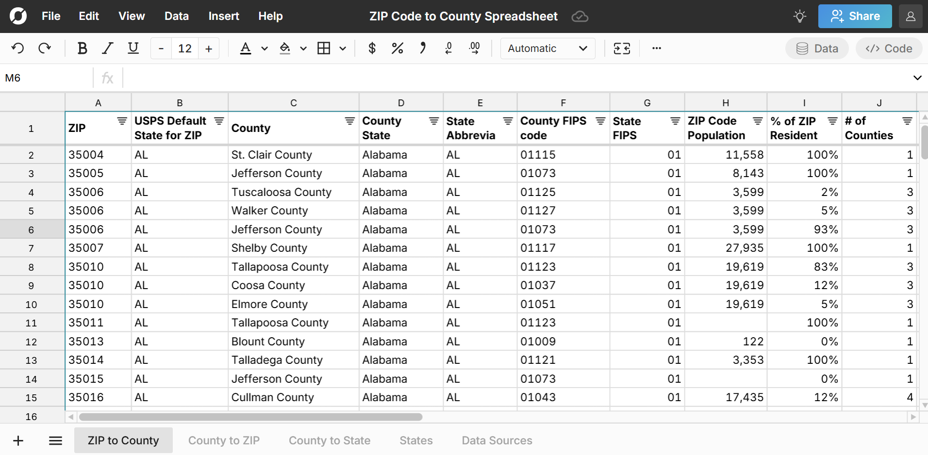
ZIP to County
The ZIP to County sheet includes a list of all U.S. ZIP code to county FIPS code mappings. Since ZIP codes can overlap with multiple counties, there are multiple rows for many ZIP codes - one for each county they overlap with. To make this easier to work with, we've included a column for '% of ZIP residents in county' and '# of counties' a given ZIP overlaps with. 
County to ZIP
The County to ZIP sheet lists ZIP codes by county with one row for each combination of county and ZIP code. The sheet includes a column for '% of County Residents in ZIP' so you can easily sort to see the largest ZIP codes by county in terms of their contribution to the county's population. 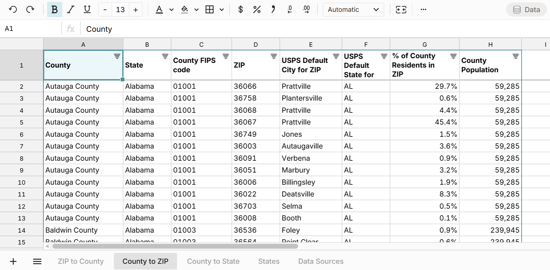 You can use this sheet to easily map county FIPS codes to ZIP codes.
County to State
The County to State sheet includes a list of all U.S. counties with their state. The sheet includes county FIPS codes and state FIPS codes, so you can easily crosswalk county FIPS codes to state FIPS codes. The sheet also includes county and state population data, so you can easily look up largest counties by state. 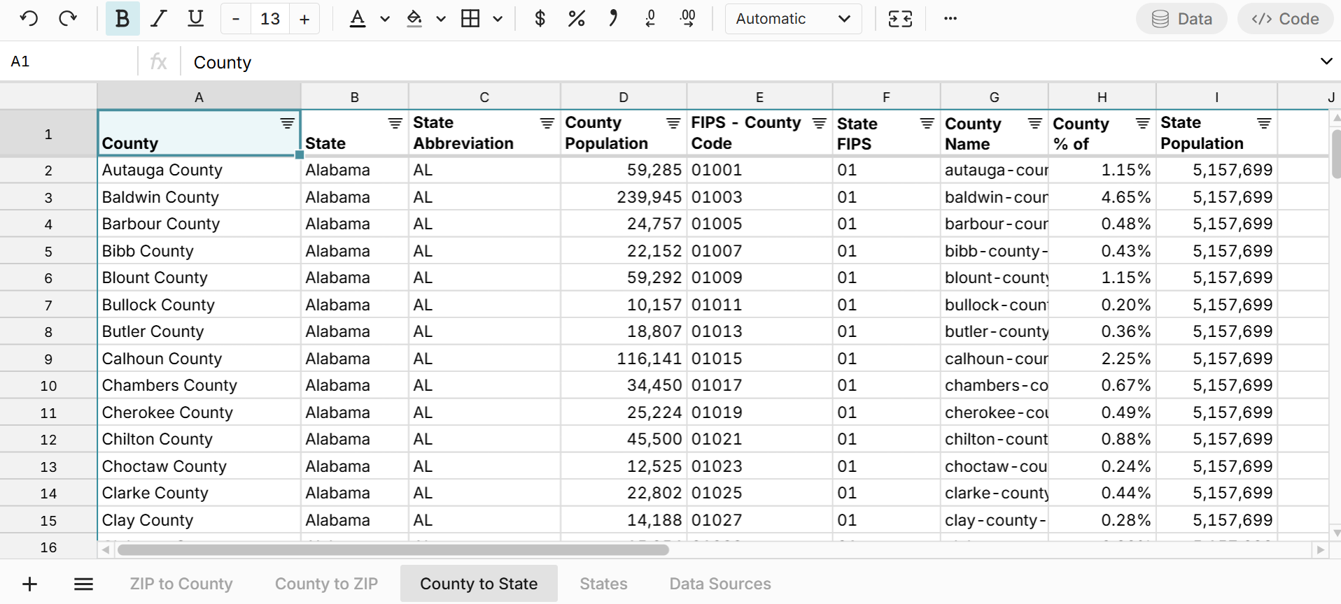
State FIPS codes
The States sheet lists each state along with the state FIPS code and population, so you can easily lookup state data. 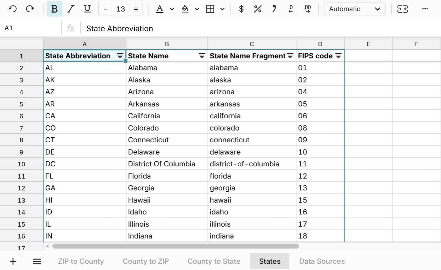
Use Cases for this Dataset
Row Zero is a spreadsheet for big data, so you can easily import your data into this ZIP to county spreadsheet (or vice versa) to map your data or just start exploring the data with filter, sort, functions, pivot tables, charts, etc. Here are a few common use cases:
- Enrich your current datasets with county or state data. You can use XLOOKUP to map ZIP codes to county or state.
- Import the ZIP to county crosswalk data directly to your database or data warehouse, so that you can enrich any ZIP code data in your data warehouse. Row Zero supports write-back to your data warehouse. You can connect to Snowflake, Databricks, Redshift, Postgres, and more.
- Lookup county by ZIP code or ZIP codes by county. You can filter the spreadsheet to drill down to the data you want to see or sort to see largest ZIP codes by county. This spreadsheet also makes it very easy to view all counties a ZIP overlaps with.
Data Sources
Data sources for ZIP code to county dataset include the U.S. Census Bureau 5-year estimate tables from the American Community Survey, as well as the U.S. Office of Housing and Urban Development. ZIP code population is included for ZIP Code Tabulated Areas (ZCTAs) which are ZIP codes of populated areas. Data has been updated as of September 2025 with the most recent data available.