Explore the comprehensive dataset of U.S. FIPS codes with lists of FIPS codes for all U.S. locations and mappings of FIPS codes between locations. You can use this free FIPS code lookup to map town and county FIPS codes to state FIPS codes. You can also map ZIP codes to FIPS codes and FIPS codes to CBSA codes (metro areas). The dataset also includes a list of countries with ISO codes. Explore for free in Row Zero, a powerful spreadsheet built for big data.
Dataset Summary
This free FIPS code spreadsheet includes several different sheets of U.S. FIPS code lists by location level including FIPS codes for cities, towns, and places, county FIPS codes, and state FIPS codes. FIPS stands for Federal Information Processing Standards. FIPS codes are unique codes used to identify U.S. locations and they are often included in location datasets from the U.S. Census and other government agencies. You can also use FIPS codes to map U.S. locations across geographic levels (e.g. town to county to state).
This dataset includes FIPS codes and population for each location level. It also includes all U.S. ZIP codes and ZIP code to FIPS code lookups as well as CBSA codes for metropolitan statistical areas and ISO codes for countries worldwide.
The workbook contains the following sheets:
- County FIPS codes
- State FIPS codes
- ZIP codes to FIPS codes
- FIPS codes for U.S. Places
- CBSA Metro and Micro Area codes
- U.S. Region codes
- Country ISO codes
- U.S. Congressional District IDs
- ZIP code mappings
View comprehensive population, demographics, and income datasets for U.S. locations.
County FIPS codes lookup
The County FIPS codes sheet provides a FIPS code list of counties in the U.S. and maps each county FIPS code to state FIPS code. It also includes the population of every U.S. county. Easily filter to see the list of county FIPS codes by state using this free FIPS county code lookup. Note that the first two digits of each county FIPS code are the state FIPS code.  View detailed County Demographics Datasets.
State FIPS codes lookup
The State FIPS codes sheet provides the list of state FIPS codes with population by state and maps each state FIPS code to U.S. region.  View detailed State Demographics Datasets.
ZIP codes to FIPS codes mapping
The ZIP codes to FIPS codes sheet provides the list of USPS ZIP codes with their population and maps each ZIP code to state FIPS code and county FIPS code as well as CBSA codes for metropolitan statistical areas. You can use this sheet to lookup FIPS codes by ZIP code or conversely filter to lookup ZIP codes by FIPS code. Note that this sheet includes the primary county for each ZIP code. The ZIP code to county mapping below includes all unique ZIP to county relationships (some ZIP codes overlap with multiple counties).  View detailed ZIP code demographic datasets.
FIPS codes for cities, towns, and places
The FIPS codes for U.S. places (curated) sheet provides a FIPS code list of towns and cities in the U.S. and maps each town and city to state FIPS codes. This sheet includes a curated and deduplicated list of real-world U.S. places using a combination of both Census Places datasets and County Subdivisions datasets. Alone, the Census Places dataset and County Subdivision datasets fail to adequately capture all real-world places in the U.S. and have significant duplication across the datasets. We've included the curated list along with the original full datasets of Census Places and County Subdivisions so you can choose whichever dataset meets your needs.

Each of these sheets includes population by town and city. Easily filter to see the list of town and city FIPS codes by state. Note that the first two digits of each place FIPS code are the state FIPS code. Census Places have 7 digit FIPS codes whereas County Subdivisions have 10 digit FIPS codes. The first 5 digits of County Subdivision FIPS codes are the county FIPS code for that location.
Metro Area CBSA codes
This Metro Area CBSA codes sheet contains the list of all U.S. metropolitan statistical areas and micropolitan statistical areas along with their CBSA code, population, and mapping of CBSA to FIPS codes for the states each metro is located in. Similar to FIPS codes, CBSA codes are unique codes used to identify U.S. metropolitan statistical areas and micropolitan statistical areas in the United States. CBSA stands for Core-Based Statistical Area and represent U.S. geographic locations that have at least one urban core of 50,000 residents for metro areas and 10,000 residents for micro areas.  View detailed metropolitan statistical area demographics and income.
US Region Codes
The U.S. Region codes sheet provides the list of region FIPS codes with population by U.S. region. It includes a breakdown of 4 high level regions (Northeast, Midwest, South, West) and 9 divisions or sub-regions (e.g. New England).
Country ISO codes
The Country ISO codes sheet contains the list of all countries worldwide along with their ISO2 and ISO3 codes as well as the population of each country. Similar to FIPS codes, ISO codes are unique codes assigned to countries worldwide and often used in public datasets as identifiers to make it easy to map country data across datasets. Generally country ISO codes are used instead of country FIPS codes. 
View detailed Global Population and Demographics data.
US Congressional District IDs
The U.S. Congressional Districts sheet contains the list of U.S. congressional districts along with their population and mappings to state FIPS codes. The first two digits of each U.S. congressional district code are the state FIPS codes. 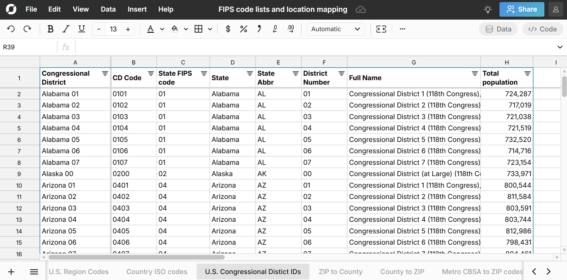 View detailed Demographics and Income by Congressional District.
ZIP code mappings
In addition to the ZIP codes to State FIPS codes sheet above, the last several sheets in the workbook contain mappings of ZIP codes to FIPS codes, CSBSA codes, and congressional districts:
- ZIP codes to County FIPS codes: This sheet maps each ZIP code to county FIPS codes. ZIP codes can map to multiple counties so those are included in multiple rows with one row for each unique ZIP code to county relationship. The dataset also includes the percentage of each ZIP code in a county so you can easily see the primary county for each ZIP code.
- County FIPS to ZIP code: This sheet maps each county FIPS code to ZIP code relationship and includes the population of each county that lives in the ZIP code.
- Metro CBSA to ZIP code: This sheet maps each CBSA code to ZIP code and lets you easily filter to see the list of ZIP codes in each CBSA metropolitan statistical area and micropolitan statistical area.
- ZIP code to Congressional District: This sheet maps each ZIP code to U.S. congressional district and includes the percent of each ZIP code population that lives in the congressional district.
- Congressional District to ZIP Code: This sheet maps each U.S. congressional district to ZIP code relationship and includes the percent of the congressional district that lives in each ZIP code.
Use Cases for this Dataset
Row Zero is a powerful spreadsheet built for big data, so you can easily import your data into the FIPS code lookup spreadsheet (or vice versa) for several use cases:
Lookup FIPS codes by location for U.S. places and filter and sort by geographic level.
Map location data across different datasets using XLOOKUP to join datasets using FIPS codes.
Import FIPS codes to your database or data warehouse. Row Zero has built-in connectivity to Snowflake, Databricks, Redshift, Postgres, BigQuery, and Amazon S3, so you can easily standardize location data in your data warehouse.
Calculate market penetration by location. Use the standard location codes and population data to map your customer data to FIPS codes and calculate geographic penetration for any country or U.S. location.
View the FIPS code spreadsheet
Data Sources
Data sources for this FIPS code dataset include the U.S. Census Bureau 5-year estimate tables from the American Community Survey, as well as the U.S. Office of Housing and Urban Development. Country data comes from the United Nations Department of Economic and Social Affairs. Data has been updated as of March 2025 with the most recent data available.