This dataset provides comprehensive town and city data including U.S. population statistics and census data. View population by city, town, and place with breakdowns by income, age, gender, and race demographics. Explore for free in Row Zero, a powerful spreadsheet built for big data.
- Dataset Summary
- Challenge creating a definitive list of all U.S. places
- Highlights from the dataset
- Data sources
- Related datasets
Dataset Summary
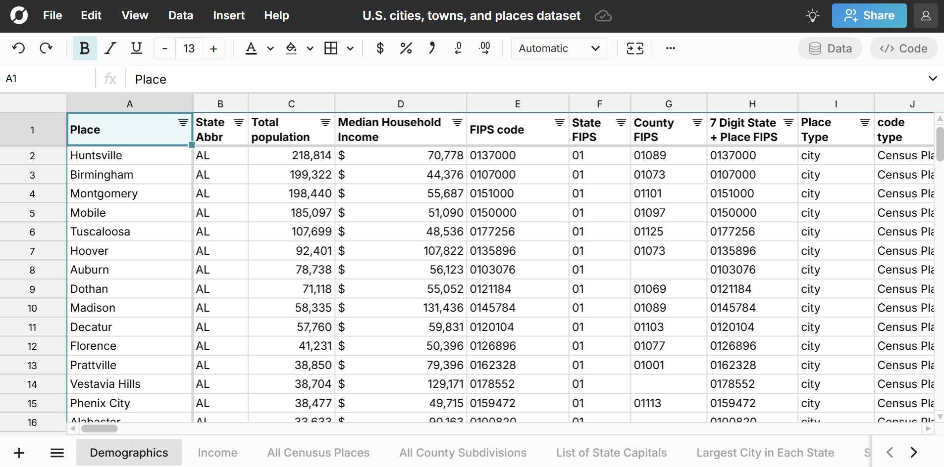
This spreadsheet includes several different sheets of U.S. places data from the U.S. Census Bureau. Explore town and city demographic data including city population by age, gender, and race and median household income by city and town. The dataset also includes city and place FIPS codes which can be used to look up U.S. locations across location datasets. Here are the sheets included in the dataset:
- Demographics
- Income
- All Census Places and County Subdivisions
- List of State Capitals
- Largest City in Each State
- State Demographics
Notes:
- The first two sheets include a curated and deduplicated list of real-world U.S. places using a combination of both the Census Places dataset and County Subdivisions dataset. Alone, the Census Places dataset and County Subdivision datasets fail to adequately capture all real-world places in the U.S. and have significant duplication across the datasets. We've included the curated list along with the original full datasets of Census Places and County Subdivisions so you can choose whichever dataset meets your needs.
- The town and city datasets are for the city itself, not the overall metro area. View demographics by metropolitan statistical area.
US Place Demographics - Age and Gender
The Demographics sheet includes population by age and gender for all U.S. locations with both raw counts and percentages. 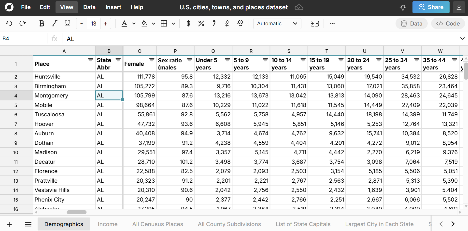
Race Demographics by City and Town
The Demographics sheet also includes race breakdown by city, town, and place with both raw counts and percentage breakdowns for single race and multiracial residents including high level breakdowns (White, Black, Hispanic, Asian, etc.) and more specific breakdowns (Chinese, Japanese, Korean, etc.). 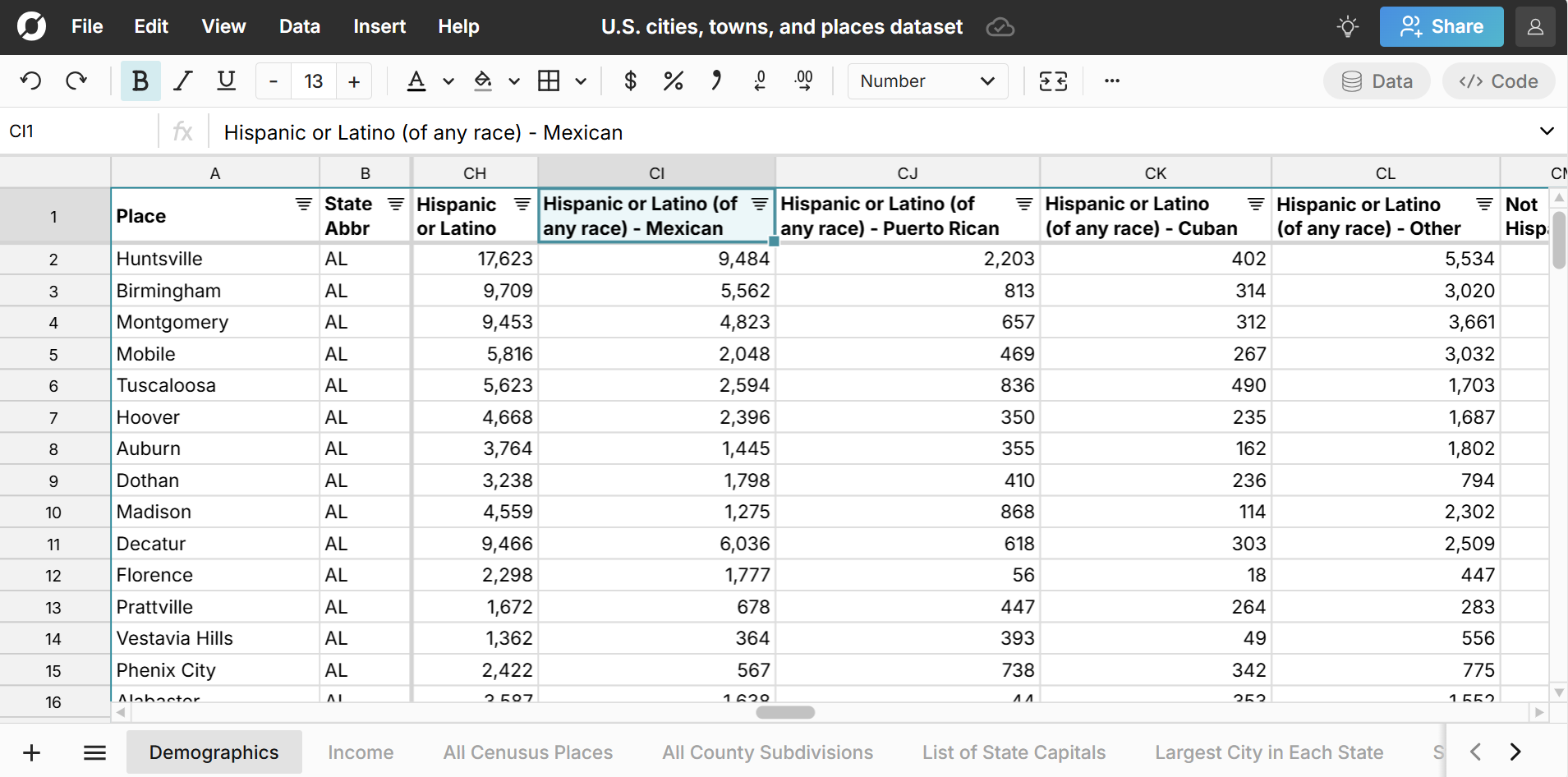
Income by City and Town
The Income sheet includes median household income by city and town as well as mean income, family income, and percentage breakdown by income bracket. 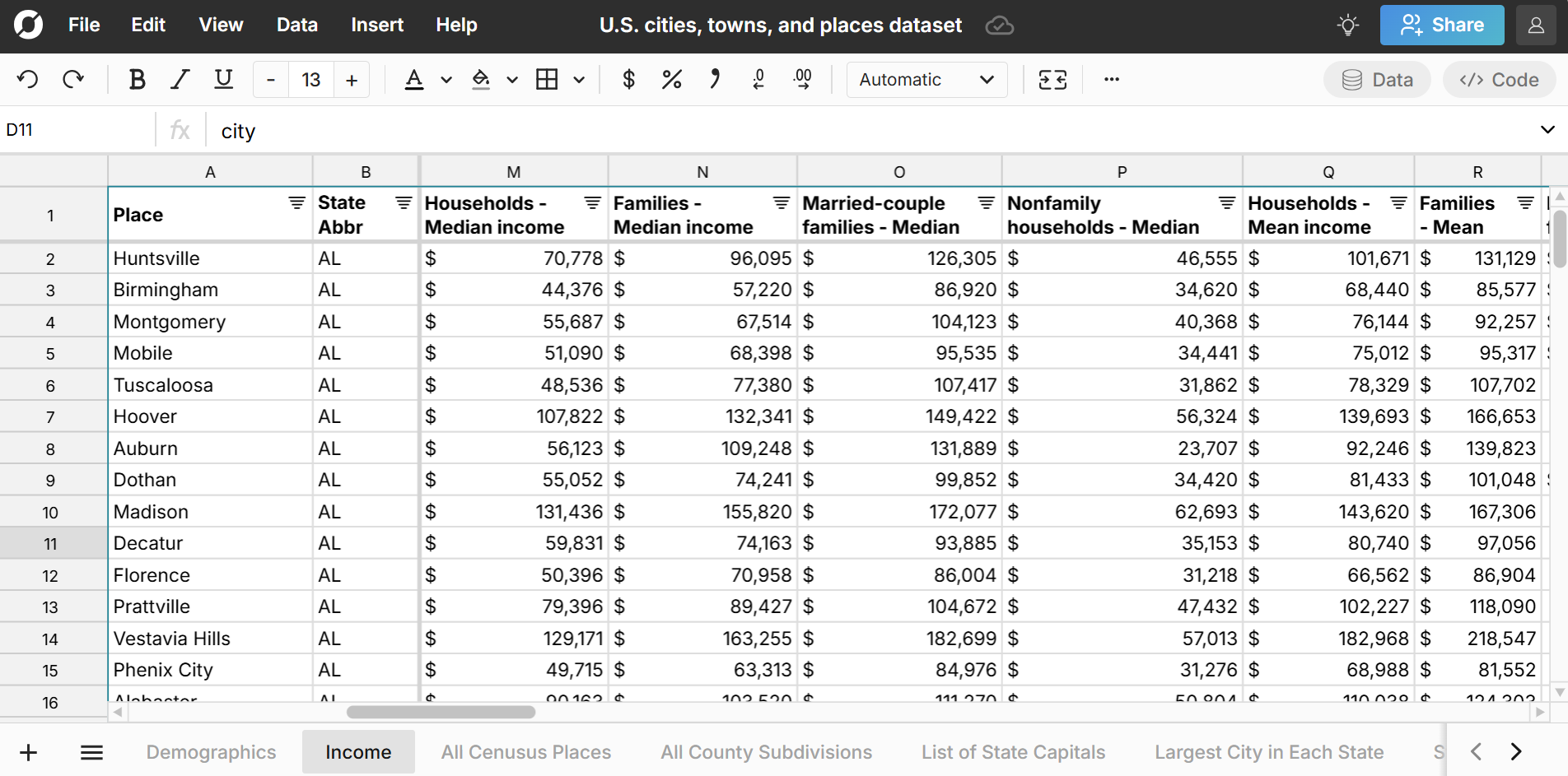
All Census Places and County Subdivisions
The All Census Places and All County Subdivisions sheets contain the original Census datasets of U.S. places that were curated and de-duplicated to make the sheets above.
Largest Cities in Each State
View the list of largest cities by state in the spreadsheet. 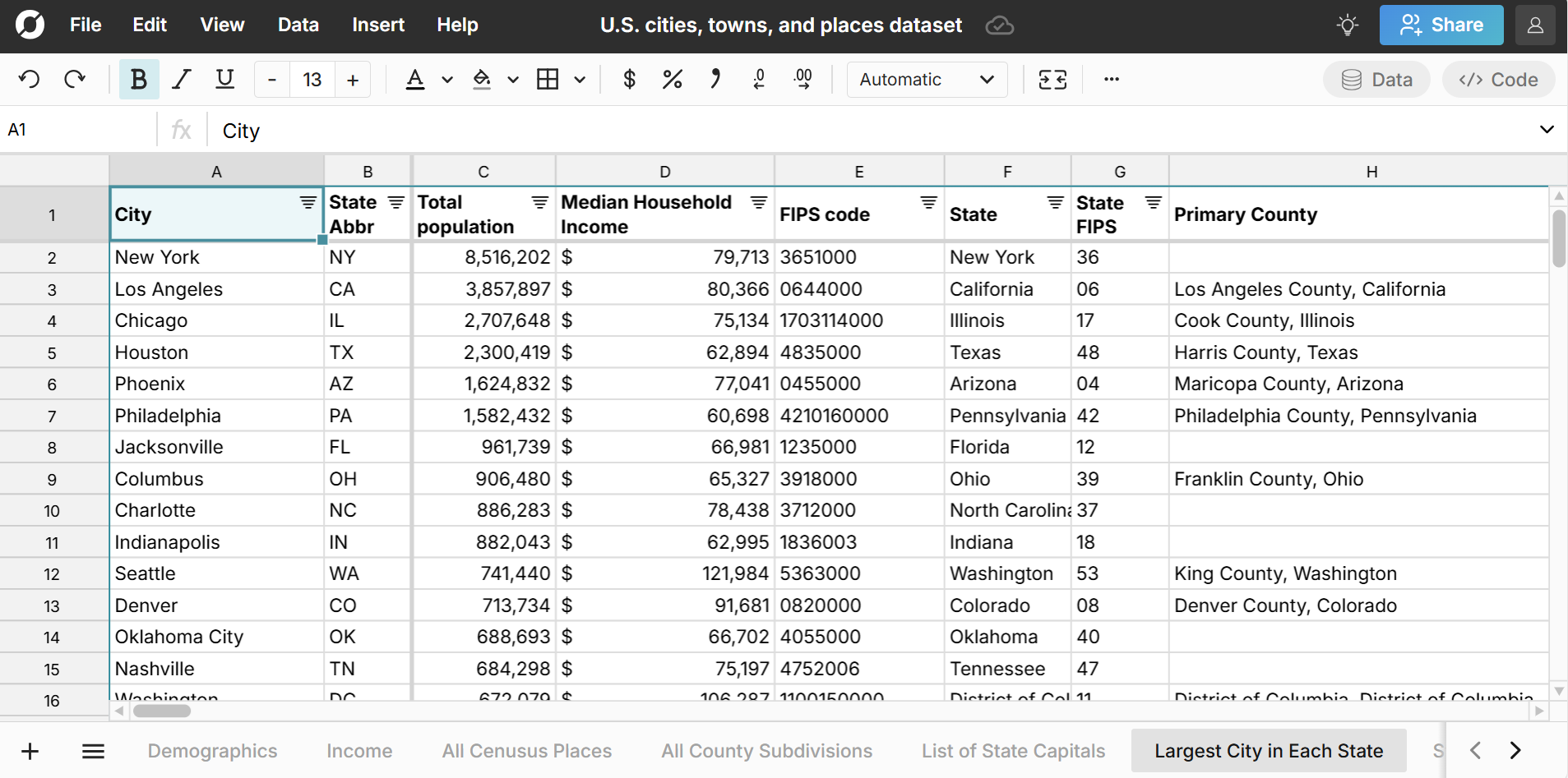
US State Capitals
View the list of U.S. state capitals with population and median income. 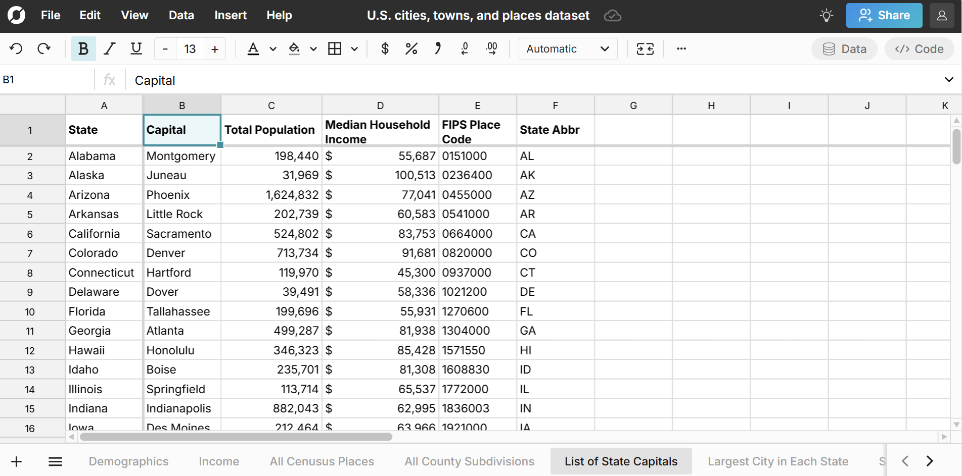
State Demographics
The last sheet includes state demographic and income data so you can compare each city and town to its state.
Challenge creating a definitive list of all U.S. places
While there are definitive lists of U.S. ZIP codes, counties, metro areas, and states, there is not one, definitive list of all U.S. places at the city, town, and local government level. Many areas are loosely defined, have overlapping boundaries with other places, and are called different names depending on the context. Some Census defined areas are purely for statistical purposes.
In this spreadsheet of U.S. places, we've attempted to curate and combine multiple U.S. census datasets to establish a comprehensive list of U.S. places that reflect real-world locations. In particular, we combined and curated datasets of Census Places with datasets of Census County Subdivisions. In general, Census Places are more likely to reflect real-world places, so we defaulted to Census Places where conflicting locations existed. However, Census Place datasets fail to capture many real world places. In some states, County Subdivisions are purely for statistical purposes, but in other states, County Subdivisions reflect real-world places not represented in the Census Place datasets. Here's one example - Mount Lebanon Township in Pennsylvania is a popular suburb in the Pittsburgh Metro Area. It does not show up in the census place datasets but does show up in the census county subdivisions datasets. Pennsylvania is a state where townships often reflect real-world places. However, in other states, townships are meaningless subdivisions of locations.
The goal for this spreadsheet was total coverage of real-world places, while minimizing overlap. One significant exception is the 5 boroughs of New York City - Brooklyn, Bronx, Manhattan, Queens, and Staten Island. These were included because of their size and well-known and well-defined boundaries even though they are subsets of New York City.
To help avoid confusion, the dataset includes a column for place type and also includes original datasets for All Census Places and All County Subdivisions.
Highlights from the Dataset:
Largest Cities in the U.S.
Top 10 most populated cities in America:
- New York, NY - 8,516,202
- Los Angeles, CA - 3,857,897
- Chicago, IL - 2,707,648
- Houston, TX - 2,300,419
- Phoenix, AZ - 1,624,832
- Philadelphia, PA - 1,582,432
- San Antonio, TX - 1,458,954
- San Diego, CA - 1,385,061
- Dallas, TX - 1,299,553
- San Jose, CA - 990,054
View the full list of cities in the spreadsheet. Note, this city ranking is for the city itself and not the total metro area. View largest metro areas in the U.S. here.
You can also easily filter the spreadsheet to see the largest cities by state and largest cities by race, age group, or gender breakdown.
Wealthiest Cities in the U.S.
Top 10 Wealthiest Cities in America in terms of median household income. Limited to major cities with a population of at least 100,000 residents:
- Sunnyvale, CA - $181,862
- Fremont, CA - $176,350
- Santa Clara, CA - $173,670
- Bellevue, WA - $161,300
- San Mateo, CA - $152,669
- Naperville, IL - $150,937
- Frisco, TX - $146,158
- San Jose, CA - $141,565
- San Francisco, CA - $141,446
- Carlsbad, CA - $139,326
View the full list in the spreadsheet and filter to see the wealthiest towns and cities by state.
Use Cases for this Dataset
Row Zero is a next-gen spreadsheet built for big data, so you can easily import your data into the spreadsheet (or vice versa) to map your data or just start exploring this comprehensive dataset of all U.S. places. Here are a few common use cases:
- Look up population by city, town, and place and filter, sort, and pivot to quickly analyze city data in a spreadsheet.
- Rank cities and towns by state, county, and metro by size and percent breakdown for demographic statistics like age, gender, and race.
- Enrich your current datasets with U.S. places data. You can use XLOOKUP to join location datasets or import location data directly to your database or data warehouse. In particular, the city FIPS codes can be used to map city data across datasets.
- Evaluate the diversity of any town in America by race, gender, age, and income.
Data Sources
Data sources for this town and city dataset include the U.S. Census Bureau 5-year estimate tables from the American Community Survey, as well as the U.S. Office of Housing and Urban Development. Data has been updated as of March 2025 with the most recent data available.